If you’re visiting Paris, you’ll likely hear about the RER and Transilien, two essential public transportation systems for getting around the French capital and its surroundings. Here’s everything you need to know to use these networks efficiently during your stay.
The RER: the Regional Express Network
The RER is a fast train system that runs through Paris and extends to many cities in the Île-de-France region. With its five main lines (A, B, C, D, E), the RER provides smooth connections between central Paris and iconic destinations such as Disneyland Paris (line A), Charles de Gaulle Airport (line B), and the Palace of Versailles (line C).
THE TRANSILIEN: EXPLORING ÎLE-DE-FRANCE BY TRAIN
The Transilien is a regional train network operated by SNCF. Unlike the RER, the Transilien does not run through Paris but connects major Parisian stations (such as Gare de Lyon or Gare Saint-Lazare) to towns and villages in the Île-de-France region.
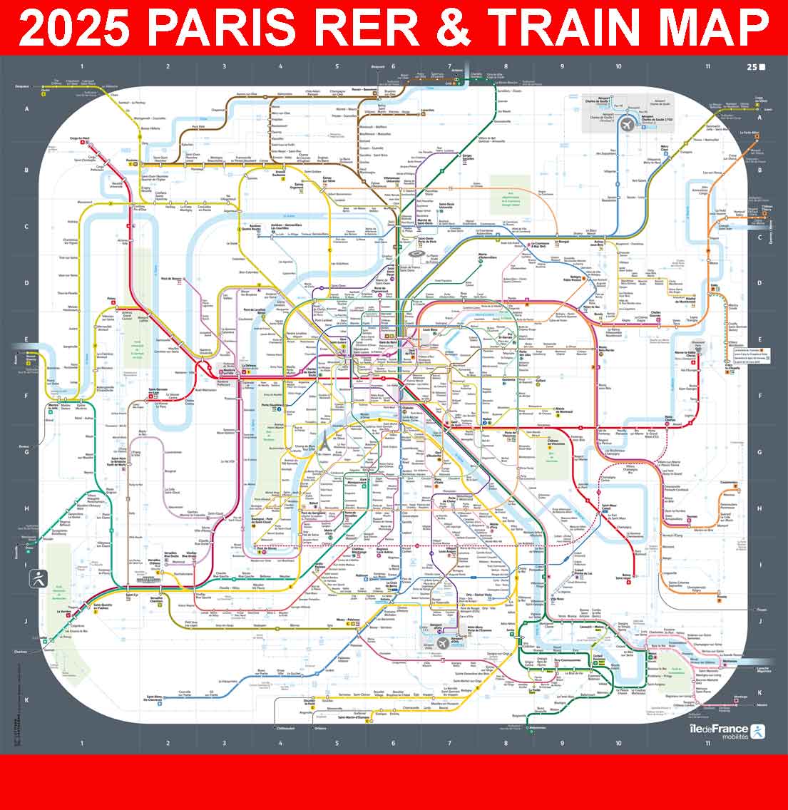
2025 Map of the Paris RER and Transilien Network
Here is the updated 2025 map of the RER and Transilien network, including the recent western extension of the RER E (Porte Maillot and Nanterre). Click on the image to open the map in PDF (high quality).